

| Home | GIS for you | Useful GIS | About us | Contact us |
![]()
| GIS for You | GIS Applications | Watershed GIS |
GIS Applications
![]()
GIS Applications are possible in all disciplines now. Any subject or stream where there is data spread over a certain area needs GIS. A GIS is formed out of maps of the area with details and information displayed over it or attached in the form of database. Urban development, Watershed, Rural development, Forest management, Agriculture, Health, Education, Fisheries, Water- resources, etc. are some of the common areas where GIS applications are made. Be it planning, reporting, evaluation or monitoring of activities, GIS helps the most. It is now also commonly seen that activities like Marketing, Transport, Tele-communications and such other, are also making use of GIS for better control and management of activities. |
|||
 |
After putting the data onto maps and forming GIS, many new analysis processes begin to take place, which otherwise are never possible
GIS applications enhance decision making [that is how it is called as Decision Support System or DSS]. which lead to - much improved and error free planning, - more efficient reporting, and - most effective montoring. |
||
Thus GIS applications make the best support for the management of any activity, project or programme. A better planned and managed activity guarantees results, which is what any programme aims at. Assured return of resources and funds is thus achieved with induction of GIS tools for support. Who would not like to adopt GIS now!!. |
|||
Applications Unlimited:
![]()
GIS has applications in innuerable domains, for example - environment, agriculture, forest, ocean, meteorology, geography, geology, hydrology, archeology, land management, socio-economics, demography, health education, tourism, transportantion, aviation, colonisation, defence, industries and so on.
 |
With the increased awareness about use and advantage of GIS applications and also with rise in availability of support, the businesses and activities are fast employing GISs. Government and private bodies both make use of GIS as much as computers are used. When we include Remote Sensing to accompany GIS, the powers of GIS increase many times further. With support of satellite based information, the exact, in-situ details help augment the levels of GIS utilisation. |
How can GIS be created and put to applications is described on this website on pages like GISforYou, Watershed GIS and others.
It is most essential for all to also sincerely browse through the case studies, to know how best the GIS techniques can be applied in different fields. Some of the useful Links are given below that will take you into the world of GIS applications in different sectors:
![]()
![]() State's
Village Index/ Mazmuli based GIS developed by NCHSE:
State's
Village Index/ Mazmuli based GIS developed by NCHSE:
As
there was necessity felt by all the users of GIS and organisations and
individuals going in for computerised mapping, that the base maps of all
the districts and talukas/tehsils/blocks should be available pre-digitised.
It is unfortunate that no agency had made it available for common
applications since long. Since there was this basic requirement felt by
NCHSE, based on requests from different organisations a massive task of
mapping of Mazmulis (the village index maps) was undertaken under an
assignment from Denish International Development Agency (DANIDA) and all
the maps numbering 313, were digitised. This is finally released in the
form a comprehensive GIS which is provided to users on requirement
basis. NCHSE provides this package for the government departments/organisations
through the Madhya Pradesh Consultancy Organisation.__
![]() District wise Village
level GIS
:
District wise Village
level GIS
:
__ The
ultimate help in Plannig, Monitoring and reporting field level activities
The village boundary maps of all districts and blocks are available for use along with a special GIS software. This provides basic data about villages on a click. The field level data about any programme, say NREGS, may be included. This would offer a powerful base for programme planning and monitoring.
See
Details and Samples
Ask
us for assistance for your District or your Project villages
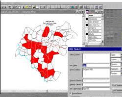
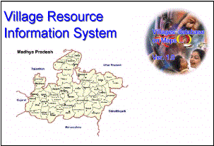
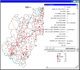
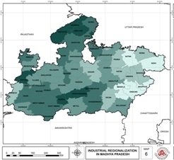
GIS APPLICATION AREAS:
[click on Images below]
|
|
|
|||||
|
|
|
|||||


Those who are already applying GIS, need to explore what more can be done with GIS. Those, aware of GIS, need to start applying it now. Those, unaware about GIS, need to learn and start using. Why should we be falling into lot of lagging ones, if GIS has already made its place everywhere!
![]()

![]()
Important: This page presents picks from the Indian and other websites from the globe. The names of the authors/publishers or reference of the original publishing site, etc. releasing these articles are also given along with. The issues covered are the GIS, GIS industry, GIS Application examples, etc. There is as such no special criteria of selection of these picks and or such sites/pages being provided link here. The editorial team and the supporting technical staff found these articles worth quoting due to the technical importance and relevance of reading purely in their personal opinion and that is why these are selected. Any article/publication being missed out or not given place here, is absolutely unintentional, and the designers, the editorial team along with support staff for the website, in no case, must be held responsible for this. However, we shall welcome addition of new suitable material if any one refers to us and please feel free to ask for it giving the URL.
![]()
Applications of GIS in Agriculture, Ecology, Meteorology,
Property, Tourism ...
http://www.supergeotek.com/Library_GISApplication.aspx
GIS based
application for Rural Development - A Policy Warranted
http://www.gisdevelopment.net

___________________________________________________________________
|

 |
 |
|
As
the scope of GIS is expanding, career opportunities have drastically
increased for GIS knowing people. High paid jobs, class environment, are
assured terms in this industry. Opportunities abroad are even
more.
Learning GIS for the sake of employing GIS in routine works and exploring the powers of this wonderful tool to bring about change in activity management needs just a bit of GIS Training. Enter the door below:
|
Thinking of buying
GIS!
Do not delay
GISs are available in the market. These are many; and as many are the cost ranges. GIS manufacturers provide lot of information on Internet also. We shall try to help you provide with some linkages. The GIS applications is of-course our domain. Enter
the door below: |
|
WHAT all is on MPGIS: |
Liked it! SHARE THIS PAGE with friends and others _______________________ |