


| Home | GIS for you | Useful GIS | About us | Contact us |
![]()
| Useful GIS | GIS Utilities | Maps & Maps |
| click here |
Useful GIS |
|||
| KNOWLEDGE Section: |
Map policy of India:
The Map Policy of India is an important document for all concerned with Mapping and GIS, that is prepared by the central govt. National Map Policy would govern mapping and mapping related issues. It reads as "All socio-economic developmental activities, conservation of natural resources, planning for disaster mitigation and infrastructure development require high quality spatial data. Advancements in digital technologies have now made it possible to use diverse spatial databases in an integrated manner. The responsibility for producing, maintaining and disseminating...." ....Read More
Besides, the SoI has framed Guidelines for the implementation of the policy. "The Central Government announced the National Map Policy (NMP) on 19th May
2005. The NMP document authorizes Survey of India (SOI) to issue detailed
guidelines on the implementation of the NMP. The guidelines are issued in
light of ...." ....Read More
![]()
Need guidance 'To Buy Survey of India Toposheets':
We often require to obtain the Survey of India toposheets for our project requirements. It is but one most authentic source of information and for all kinds of geo-referencing needs, it is taken as the sole firm basis. There are issues related with procuring the toposheets and you must know them before hand to make the job easier. Toposhteets are made available at cost by the SoI HO Dehradun, Uttaranchal. You may have to write them your requirement on letter addressed to Director, National Geo-spatial Data Centre, Block 6, Hathibarkala Estate,
Dehra Dun (Uttarakhand) Email: dmadc.soi@nic.in, website:surveyofindia.gov.in. After knowing the availability from them of required toposheets they must be again approached to place the order for supply of sheets. This will be in a prescribed form available on the SoI website.
As per the over all structure, SoI maintains many outlets at different places for sale of toposheets and also several Geo-spatial Data Centres. You may approach them also for availing information about availaibility and then for ordering. These are just the print products normally supplied by SoI. But you may also try for digital OSM data.
![]()
Satellite Products of ISRO
NRSA [National Remote Sensing Agency/Centre]
NRSC is the sole source of obtaining the Indian Satellite data products. The Remote Sensing images are available for different satellites. The costs have drastically come down and these products have become somewhat more affordable now, thus making it possible even for small projects to buy and use the data. Satellite data is unmatched and there is no replacement for it. Take the scene of present times or even ask for some of earlier years, NRSC supplies them all. It needs little more technical knowledge to ask for the right data of right resolution. Some technical advice must be taken or else, do contact sales@nrsc.gov.in the NRSC directly with questions and they shall guide. There are several products and a set procedure to order for it.
![]()
Know about Maps more
The maps are result of fairly technical exercise. Using maps also requires that one must know the theory and principles behind mapping. It is useful and essential. There are different kinds of maps - of different scales and projections. There are various components in a map. To know them all .... Read on. |
 |
![]()
UTM
Universal Transverse Mercator Grid System (UTM) [U.S.G.S. Definition]
"The Universal Transverse Mercator Grid System (UTM) provides rectangular coordinates that may be used to indicate locations of points on the surface of the Earth. UTM involves linear measurements, and the unit of measure is the meter. A point is located by specifying a hemispheric indicator, a zone number, an easting value, and a northing value.
 |
UTM is designed for world use between 80 degrees south latitude and 84 degrees north latitude. The globe is divided into narrow zones, 6 degrees of longitude in width, starting at the 180 degree meridian of longitude and progressing eastward. The zones are numbered 1 through 60. Each zone has, as its east and west limits, a meridian of longitude. Each zone also has a central meridian passing through the center of the zone. The location of any point within a zone is given in relation to the central meridian within that zone and the equator. The system zone yields positive values for the identification of a point on the earth's surface by first assigning numeric values to the equator and the central meridian. Then, a point's north-south location is obtained by either adding or subtracting the point's distance north or south of the equator. Similarly, a point's east-west location is obtained by either adding or subtracting the point's distance east or west of the central meridian.
A value of 500,000 meters is assigned to the central meridian of each zone in order to avoid negative numbers at the west edge of the zone. The values increase from west to east. For north-south values in the northern hemisphere, the equator is assigned 0 meters, and the numbers increase toward the north pole. In the southern hemisphere, the equator is assigned 10,000,000 meters, and the numbers decrease toward the south pole.
On a map, appropriate values for the easting and northing of a point are determined relative to labeled grid lines. A point on the equator is assigned a value of zero for its northing and is treated as if it were in the northern hemisphere. A point on a boundary meridian is assigned the zone number for the zone to the east of the point."
http://mcmcweb.er.usgs.gov/sdts/SDTS_standard_nov97/part1an3.html
![]()
Geographic/UTM Coordinate Converter
http://home.hiwaay.net/~taylorc/toolbox/geography/geoutm.html
You often require to convert the coordinates from Geographic to UTM and also the back from UTM to geographic. The utility is here to do this job with accuracy and with a click.
______________________________________________ (...click here)
![]()
Useful GIS Websites
|
Google map: a synonym for Web based maps these days. The advantage of seeing the map online, without really possessing one. You get on Google map all the world on your screen. The Google map has images served with lot features: say, satellite scene, digitised - vector maps, hybrid, and others. Google map has also emerged as an interactive and attachable map system for anyone and everyone to use. Google Map with support of downloable software makes the information so usable that you may overlay your map layers and save from re-doing the mapping. Also have it published for your authorised users to use. So, what are you waiting for.. get the Google Map here and now. |
||||||||||||||||||

|
on /wps.prenhall.com |
 |
 |
GIS Lounge has proved that the Web based content may be equal to a bank of knowledge. It is rich on GIS learning matter and also very inormative. |
This is satellite image of earth - of recent times - online and viewable for different satellites and positions. Watch the part of globe at the day and night time. |
Day and Night from satellites |
|
http://www.fourmilab.ch/cgi-bin/Earth?opt=-p&img=learth.evif |
||
Govt. of
India Tender Information System
|
|
|
Wiki Mapia is ever powerful. Your Mapper where you may add and modify content of your interest. Your Mapping window to the world at your command.
|
|
NRSA is the agency for all kinds of Remote Sensing data in India. The products of ISRO are rated top in the world for accuracy. The resolutions of variety and combinations are available. Get some guidance right here, on top of this page and also with the portal accessible from the links.
|
|

|
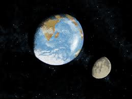
A students' project for Students Study the useful science of Earth and Moon and upgrade your knowledge. |
|||
___________________________________________________________ ___________________________________________________________
__ Useful GIS software Downloads
And here is one the largest collection of Useful GIS Software downloads. Free. When the page opens, scroll down to GIS list. You need to download one if you don't have. Even if you have some, do find out what does the Free software do.. which may be much useful !!. |
Open GIS is the latest. There is no need to buy expensive GIS from big companies anymore. Learn and download few and start using the Open GIS software, here and now.
|
ONE OF THE LARGEST
|
_____________________________________________________________________________________

_____________________________________________________________________________________

 |
| Download some Free GISs .... Click Here. You may be interested to download some Free GISs .... (go to the GIS section on page opened) |
 |
Select One |
||||||
|
Take an online Survey TECHNOLOGY
|
GAMES TIME !!  |
Liked it! SHARE THIS PAGE with friends and others _______________________ |
Explore more on MPGIS!!
|
|