

| Home | GIS for you | Useful GIS | About us | Contact us |
| GIS for you | GIS Applications | Watershed GIS |
| click here |
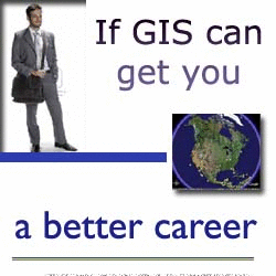
GIS JOB opportunities for you - on Web
![]()
The Satisfying GIS Profession:
The GIS is the biggest demand these days. All buisnesses are opting for employing GIS for their day to day works. GIS is also now becoming a part of the government projects and programmes to assist the activities of planning or overall management. Thus, the application of GIS is increasing at an amazing pace which was never seen before.
The demand for the GIS manpower is so much that it is not fulfilled in many cases and works also suffer because of short of human resource.
The latest trends show that it is the GIS industry which maintains the manpower at one of the highest rates of emoluments. Also one sees significant stability of career in this sector since there is continuity of GIS works from all around including works from overseas.
|
No one would ever switch back from the GIS occupation once he/she gets into this ever rewarding profession. Talking about India, there are lot of prospects within the country in this upcoming field. The GIS persons stand very good chances of getting jobs abroad since the manpower demand there is enormous that normally lies unfufilled. |
It is the most appropriate time to grab a good opportunity in GIS sector of whichever application area you like and feel comfortable with. A job in hand would fetch you another and you would continue to always get suprising rise in your career - for sure.
![]()
Search for JOBS at GISjobs.com
|
A very useful GIS Job portal with lots of opportunities for categories from cartographers to GIS experts to developers. A worthy site for the worthy people. |
![]()
 |
||
Look for Jobs- GIS Analysts, GIS and Web GIS Developers, GIS Sales, Project Managers, Photogrammetry technician, Trainee.. A huge database of JOBS avaliable around the world - GIScareers - a site with one of the heaviest collection of jobs and jobs. |
||
![]()
See latest openings in India on GIS Jobs portal Indeed. Indeed takes you to jobs with email updates on latest openings. Goto Indeed... |
 |
![]()
See a variety of JOBs openings across the globe.. on EARTH RELATED SCIENCES AND ACTIVITIES at Earthworks-jobs - that relates Geology, Earth Sciences, Oil industry, Mining, Agri and Forestry, etc. Goto Earthworks-Jobs... |
![]()
GIS jobs all across the world. Find a large number of jibs of GIS for Indian and international organisations of all type - GIS data developer to GIS applications expert. A very useful site for
job seekers. Goto Geosys -Jobs page...
|
 |
![]()

![]()
KEEP LEARNING:
 |
The detailed science of Maps: Having map in hand is an outcome of very detailed technical process which yields a map that talks geometry of Earth with precision. The maps have scales and they have lot other standards which one must try to understand to understand significance of Mapping. [...Read on] Important Notes on Maps |
![]()
Important: This page presents picks from the Indian and other websites from the globe. The names of the organisations/firms providing these information are also given alongwith. There is, as such, no special criteria of selection and providing link here nor any interest of gaining commercially from this act. The editorial team and the supporting technical staff found these examples worth quoting due to the technical variety and relevance to the users of GIS. Any programme being missed out or not given place here, is absolutely unintentional, and the designers, the editorial team along with support staff for the website, in no case, must be held responsible for this. However, we shall welcome addition of new suitable material if any one refers to us and if you want to do so, please feel free to ask for it giving the URL.
![]()
PROJECT OF UNESCO ON GIS TRAINING:
Training Module on the Applications of GIS for On-line Governance and Accessing Public Domain Information... (...Read on)
![]()
GIS LOUNGE - A website for GIS learning
Online lessons in a wide range of subject matters for learning GIS. Take an introduction to GIS class. Other subject matters include using Census data in GIS and an Introduction to Hydrology. Tutorial for learning about spatial data, its usefulness, accessibility and the national infrastructure (NSDI) which supports it... (...Read on)
![]()
INDIAN INSTITUTE OF REMOTE SENSING, DEHRADUN:
Although formerly known as the Indian Photo-Interpretation Institute (IPI),
the IIRS was set up in 1966 under the patronage of the Survey
of India to provide hands-on training of emerging remote sensing
technology. The success of satellite remote sensing in early 1970's
created a need for personnel trained in the utilization of remote sensing
technology. The IIRS was then merged with the National
Remote Sensing Agency (NRSA)] in July 1976. This is now renamed as NRSC. |
|||
COURSES OFFERED BY IIRS |
The next decade saw the
emergence of remote sensing as a powerful tool for natural resource survey
and management, and in 1980 the NRSA was put under the umbrella of the
Indian Government's Department of Space. The main focus of the IIRS is training and education in the field of
geoinformatic. Technology and applications of Remote Sensing, GIS and GPS
are taught in the form of training and education at various levels
(decision making level to working level or fresh post graduate level). |
||
Certificate courses Specilised courses P G Diploma course |
|||
![]()
NRSA - Training at NRSA, Balanagar
NRSA [now known as NRSC] has organized training activities to train professionals, scientists as well as decision makers on Remote Sensing and GIS. A dedicated training center, Indian Institute of Remote Sensing, located at Dehra Dun gives PG Diploma course of 10-months to 4-days decision makers courses. The NRSA Headquarters at Hyderabad has a Training Division, which organizes similar training courses as well as custom made courses. NRSA has collaboration with ITC, The Netherlands for training. NRSA is a one-stop center for all the users for remote sensing data solutions. Main courses can be categorized as... (...Read on)
![]()

ADVERTISEMENT OF TRAINING INSTITUTES and PLACEMENT FIRMS ARE INVITED
Contact us...
![]()
| .spatialhydrology.com/freedownload.html |


|
Feel free to write to MPGIS about your Views and Suggestions. And we shall gladly respond to them. |