

| Home | GIS for you | Useful GIS | About us | Contact us |
![]()
| About Us | Experience | Services |
Experience and Projects Handled
![]()
NCHSE has got a vast background of working on innovative GIS applications and projects. The GIS journey that has been almost of over 15 years now, has given us experience of different kinds of GIS applications which include:
| - Rural Mapping and GIS development - Specialised Watershed Management GIS - Urban GIS - Health GIS - Commercial GIS applications, etc. |
|||
| It is only because of such a wide experience that NCHSE stands out today as a genuine service provider in the arena of GIS mainly for grass root applications. | |||
A wide spectrum of clientele:
![]()
NCHSE has received a large number of projects and assignments over the years from an equally wide range of clients, which include:
| - Government of India - Ministry and Departments - State Government departments and agencies - District Administrations - International organisations and Universities - Private bodies and individuals |
||
| It as our privilege that several organisations many a times have given us repeat orders also, and that shows the credibility of NCHSE GIS centre and also the satsfaction of our esteemed clients. | ||
| hg |
|
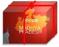
Summaries of Projects Handled Preparation of Health MIS on GIS: Sponsored by DANIDA for the Department of Health, Govt. of M.P. : An exhaustive project of detailed survey at every village and town locations in the State of Madhya Pradesh and thereafter GIS preparation of Health Infrastructure Facilities and the Health Programme Indicators was successfully carried out. A usefreindly Data retrieval and management system on GIS was created. The assignment also included Training of each of the Block Medical Officers and District Medical Officers. This mega-project ws completed by us in merely only 8 months duration.___ Village level Database for selected districts for Micro-plan activity: Sponsored by UNICEF: A village level micro-planning related data anlaysis package that was platform indepedent and was based on GIS, was developed for Guna and Shivpuri Districts of MP. The database included detailed village level information on socio-economic aspects. The package had several special statistical data analysis features assisiting planning activity which were enacted through queries on GIS_ Thematic Mapping and GIS based Action Plan Preparation: for the DRDAs, Zilla Panchayats: The area of specialisation of NCHSE is the Watershed action plan prepartion using GIS. Numerous assignments of this nature have been handled by NCHSE GIS centre so far, and many are continuing which involve thematic map genaration at the cadastral level - Village Pawtari level - highlighting information like Slopes, Drainages, Water bodies, Land use and Land ownership, Soil, etc. The Information from Patwari records is also attached to the individual land parcel. The work involves high precision, exercises of scale transformation, superimposition, etc. Highly useful outputs are produced that form the basis of major Watershed Implementation Projects. The outputs of NCHSE GIS are duly recognised both at State government and Government of India levels. Many NGOs are taking benefits of NCHSE's GIS services over past many years. Bhopal City Urban GIS Mapping: for Bhopal Nagar Nigam: The Municipal Corpration area mapping on GIS was performed for the city of Bhopal. This included digitisation of various printed available maps, mutual superimposition with an aim to achieve updations and preparation of a final uptodate map of Bhopal. Extensive field work was carried out all along to also verify the mapped information from the ground. Ward boudary delieation and corrections was also done side by side. A highly useful, multi theme layered map consisting of information on land use, roads, habitation, gardens, important land marks, religeous places, educational centres, health and commercial units, etc. has been prepared. Health Infrastructure and Services Mapping for Ujjain town: Sponsored by Karolinska Institutet, Sweden and RD Gardi Medical college: The GIS mapping for the Ujjain city for mapping of the health providers was done. Special care was taken to prepare an uptodate map of the town, using high resolution satellite data along with other available print maps which were digitised. Further the health services were surveyed and detailed information was collected about each unit. Using the GPSs the exact locations were marked on the map and the data was attached to individual providers. Thus, a very useful health providers' GIS has been prepared using customised software development. Preparation of GIS for the health service resources for TB control activities in MP: Sponsored by Karolinska University, Stockhome, Sweden: Based on secondary data on Health services infrastructure in the State of MP, a large GIS based system was developed to map the Health services infrastructure of various kinds of health providers, vis-a-vis the TB control facilities and units at different locations. This was aimed to to assist an important Swedish study through creating an at a glance picture of the spread of the health service units as an alternate support the TB related health services to help combat TB. The GIS for the State on MP for the demographic information: Spomsored by Water and Land Management Institute WALMI: A detailed GIS including the demographic information for the State to assist the village identification and data analysis for the general purposes, for the Project planning, etc. was prepared and supplied to the institute.__ Preparation of GIS for Jhabua: Sponsored by Department of IT, Govt. of India: A large GIS preparation and software development work was undertaken for varius villages of Jhabua. rarge scale maps - cadastral or Land Parcel level maps @1:4000 scales, were prepared and the specility of the project was generation ofthematic maps at that very scale derived from Survey of India toposheets and Satellite data @1:50,000 scales. The final outputs derived were the Treatment Action Plans for Micro-watersheds which covered the soil and water conservation measures. The other key output of the project was the first ever pseudo-product - Manual and software based - of GIS based watershed planning system under the name - WATMAN._ GIS based system for Monitoring of WADI projects of NABARD: An extremely useful GIS based system has been got developed by NABARD from NCHSE for periodic monitoring of Wadi programme related field activities. NGOs activities in the field are monitored using the system, as the detaile khasra maps are diogitised by NCHSE again, and included into the system. This helps monitoring from aspects of financial and physical progress of the Wadi programmes in tribal areas. Preparation of GIS based thematic Maps for the Rescue Action Planning for disasters: for Disaster Management Institute: A mapping of resources of the kind: Man, Machine and Material related information with an objective to formulate Rescue Action Plans for the seismic zones of Khadwa district of Madya Pradesh, was successfully completed. Mapping of Aids control Units in MP: for MP Aids Control Society: GIS based mapping was done of the Aids related interventions and health units in the State. This included symbolised representation of the locations of these units over the maps of the Madhya Pradesh.
Other Projects include: NREGS, Raisen: The GIS based action plan preparation work for NREGS activities was carried out for 7 blocks of Raisen district. MPRLP: The GIS based village selection system for the districts under the DFID sponsored MPRLP programme of the state. Water Resources Deptt. Govt. of MP: Santha Mapping or Water Users' Association for Water Resource Deptt. for Kolar Project. CAPART, New Delhi, AFPRO, Ahmednagar, SRI, Ranchi: GIS Software supplies for watershed planning activities to AFPRO, Ahmednagar, M.S, CAPART, SRI, Ranchi. Rajya Shiksha Kendra: Provided the GIS support for the preparation of GIS based MIS based for mapping all schools locations in MP. UNICEF sponsored Village level mapping for Uttar Pradesh districts has also been done.
|
||
|
Department of IT, Govt. of India: A massive GIS Database and software development work was carried out for Ministry of Information Technology, Govt. of India. The work was carried out for Jhabua block. Department of Health, Govt. of M.P. (through DANIDA): Madhya Pradesh GIS on village level Health Infrastructure sponsored by DANIDA UNICEF: the village level micro-planning data analysis package was developed for Guna and Shivpuri districts. Karolinska University, Stockhome, Sweden: The resources mapping for TB control activities in MP for the Karlinska University, Stockhome, Sweden Water and Land Management Institute: WALMI: The MP GIS software for all villages and towns of MP. Disaster Management Institute: Rescue action planning for Distaster Management for Khandwa Distt. For Disaster Management Institute. Bhopal. MP Aids Control Society: Data mapping work for Aids Control Society, GOMP, Bhopal DRDAs, Zilla Panchayats: Watershed Action planning for various Watershed Implementing Agencies and DRDAs NREGS, Raisen: The GIS based action plan preparation work for NREGS activities was carried out for 7 blocks of Raisen district Water Resources Deptt. Govt. of MP: Santha Mapping for Water Resource Deptt. for Kolar Project CAPART, New Delhi, AFPRO, Ahmednagar, SRI, Ranchi: GIS Software supplies for water shed planning activities to AFPRO, Ahmednagar, M.S, CAPART, SRI, Ranchi. Bhopal Nagar Nigam: Bhopal Town mapping work and ward level planning for selected places for Bhopal Nagar Nigam. Rajya Shiksha Kendra: The RSK MIS based on GIS is being carried out for mapping all schools locations in MP. MPRLP: The GIS based village selection system for the districts under the DFID sponsored MPRLP programme of the state. Karolinska Institutet, Sweden: The GIS mapping for the Ujjain city for mapping of the health providers. This included placement of health proving institutions, individuals, etc. in situ, on the city map. NABARD: The GIS mapping and softwre for WADI management with key solution for monitoring of progress of programmes.
|
||

| Contact persons: Mr.Avinash Shrivastava (+91-9406528098) Mr. Praveen Sharma (+91-9893170501) |
|
| Office Phones:_91-0755-2463731, 4277074. Fax: : _91-0755-2465651 |
|
| Postal address: National Centre for Human Settlements and Environment (NCHSE), E-5/A, Girish Kunj, Arera Colony, BHOPAL. 426016. INDIA. |
- Email : mympgis@gmail.com nchsebpl@gmail.com
 Contact NCHSE GIS Centre |

We Know Your Needs
 | |
That's how we have brought to you the village level MPGIS:Village level information linked to the village boundaries. Villages,towns of all blocks and all districts of MP covered.
Packaged in a user-friendly software for your PC. |


EXPLORE MORE ON MPGIS |
|
Liked it! SHARE THIS PAGE with friends and others _______________________ |
