


| Home | GIS for you | Useful GIS | About us | Contact us |
![]()
| MPGIS site & sw | Madhya Pradesh | GIS & Maps |
MPGIS site & software:.
![]()
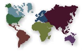
MPGIS, the Geographical Information Systems or GIS on Madhya
Pradesh, India,
is a unique initiative to cater to the needs of GIS and Maps of MP.
GIS is most commonly used tool for all sorts of planning, reporting and monitoring. It is most userfreindly and handy method for decision making from base to toplevel management. Be it government or private bodies, GIS is usable everywhere.
Madhya Pradesh GIS or GIS on MP offers support by way of providing knowledge on GIS, GIS applications, GIS mapping and mainly on GIS maps of Madhya Pradesh. This MPGIS site is extremely useful for GIS beginners as it would guide step-by-step regarding generating GIS. It educates on devising GIS solutions for any application area from Rural to Urban Development, from Health to Agriculture or Watersheds, or any other field related activity as such. If you do not know where all and how GIS is used you need to learn about it now.
GIS on MP also provides many useful links for free GIS downloads, for obtaining Survey of India topohseets, for getting Remote Sensing data from NRSA. It also helps the GIS users with several GIS utilities that they may use readily for GIS works.
Thus MPGIS is the only true friend and guide for all those who are taking to GIS or who are using GIS.
You may trust this site as a direct support for all your GIS needs. If you need further GIS assistance it is also available under GIS services. This site also would provide you maximum Maps on Madhya Pradesh.
GIS mapping; a boon:
![]()
Man has the basic instinct to understand pictures and graphical information. The voluminous data in large tables is never easy to use. But, if the same information is served on maps with illustrations, hatching - it becomes much more interpretable. It is thus far more a useful medium than narrative form of information.
 |
The maps on GIS become much more usable and featured. The GIS maps may be put to performing queries and complex analyses very easliy. As a result, many new conclusions and decisions follow. The activities get improved multifolds, planning and monitoring becomes more effective, and so on. All you need is right support. |
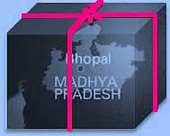
GIS: The MP GIS, from NCHSE
![]()
The State of Madhya Pradesh was privileged getting one of the first four projects in the country of Preparation of GIS under the auspices of Department of Electronics/ Ministry of IT.Govt. of India, way back in 1995. A full fledged GIS centre was established at NCHSE, Bhopal and then began the work of fulfilling the GIS needs of the State from one to all. This centre today stands out as one of reputed GIS companies in India. NCHSE GIS applications centre is contributing to GIS in India through its humble efforts.
MPGIS was created by NCHSE mainly keeping the needs of Mapped village level Information in mind. A village level GIS with units of Blocks/tehsils was prepared in 2004 under the support of DANIDA. |

The main components of MP GIS
![]()
| - | Tehsil/Block Maps showing Village Boundaries; the Village are as polygons - for all villages of MP number over 54000. |
||
| - | Data of Census is attached to each village unit, which is viewable on simple click. |
||
| - | All this has been packaged in a user-friendly, custom deigned software to make the use of the information easy and meaningful. |
||
| - | Queries have been created which serve the purpose of planning, village identification, for projects and programmes etc. |
||
| - | All kinds of GIS processing such as map integration, superimposition, analysis, etc. leading to decision support. |
It is no more a dream to have ALL DISTRICTs' ALL BLOCKs' ALL VILLAGE maps ........ it is available now. ..................ASK US / contact us.
Perhaps you are missing something if you haven't used it until now.

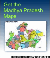
What all is on MPGIS Website :
![]()
This MPGIS website is a sincere effort by NCHSE just to support the needs of those who want to use GIS, want to learn GIS and see for themselves how useful it is!! You will see several useful pages on this site such as:
| - | Understanding GIS and browsing its uses and applications. |
||
| - | Reaching out to important GIS websites for your GIS Software and services requirements |
||
| - | and also for availing ready guidance to apply GIS in your field related works of planning, monitoring, and evaluation.. |
||
| - | There is no dearth of information on this MPGIS portal - if you want to truly equip yourself with knowledge and applying this simple technology - that is very common now-a-days. |
So read on ... and start using GIS - with ease and comfort.

You may learn GIS and get GIS training from NCHSE experts. _______________________________________________________
![]()
Counter of Visits:
|
 |
 |
 |


 |
|
|
Search Engine Optimization and SEO ToolsBusiness Directories List |
Maxxhits.com
- FREE Search Engine Submission Submit ExpressSubmit Express - SEO Services Click here to submit your URL to over 8000 search engines, directories and links pages Free. Boost your website's traffic fast!!!
|
Dial Up Internet Provider
for page counters
|