

| Home | GIS for you | Useful GIS | About us | Contact us |
![]()
| MPGIS site & sw | Madhya Pradesh | GIS & Maps |
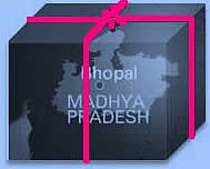
Madhya Pradesh:
![]()
The state of Madhya Pradesh was created in 1950 when the Central Provinces and Berar and the princely states of Makrai and Chhattisgarh were merged. The new states of Madhya Bharat and Vindhya Pradesh were formed out of the Central India Agency. Further, in the year 1956, the states of Madhya Bharat, Vindhya Pradesh and Bhopal were merged into Madhya Pradesh, separating the southern region of Vidarbha, that was merged with Bombay state.
Geography:
Madhya Pradesh, India's second largest state is
situated in the centre of the country. The geographical area of Madhya Pradesh
is 3,08,144 km² which constitutes 9.38% of
the land area of the country.
Madhya Pradesh has few major valleys such as
valley of the Narmada river and valley of the Tapti river. M.P. consists of a plateau with a mean
elevation of 1600 ft. above sea level which is interspersed with the mountains of the
Vindhyachal and the Satpura ranges. The climate of MP : Madhya Pradesh has monsoonal type of climate. Rains are mainly observed during the period spread over between June and October months. The average rainfall is about 60 inches or more, which is as low as 40 inches or less in the western Madhya Pradesh. The Chambal River valley and the northern Madhya Pradesh receives and less than 30 inches rainfall. The season is hot and dry during March and May months. Winters are usually pleasant and dry. |


Forests and Natural resources:
Madhya Pradesh is rich in natural resources
with diverse forests. The forest area of the state is 95,221 km². The
forest area of Madhya Pradesh is almost 31% of the geographical area of the state. The Forest area of the state constitutes as much as 12.44% of the forest
area of the country. Legally this area has been classified into "Reserved
Forest, Protected Forest and Unclassified Forest", which constitute 61.7%,
37.4% and 0.9% of the forest area respectively. Per capita forest area is 2,100
m² as against the national average of 700 m². Madhya Pradesh also has several
National Parks, which are named as:
Kanha,
Panna,
Pench, Bandhavgarh,
Satpura and also
Van Vihar in Bhopal, Madhav National Park, Sanjay National Park,
etc..
There are also several nature preserves, such as Amarkantak, Pachmarhi, Bagh Caves, Bhedaghat, Bori Nature Reserve, Ken Gharial, Ghatigaon, Kuno Palpur, Narwar, Chambal, Kukdeshwar, Narsinghgarh, Nora Dehi, Panpatha, Shikarganj and Tamia. Madhya Pradesh also has a Plant Fossils National Park in Mandla district.
World Heritage sites:
There are several tourist places in Madhya Pradesh. Some of these also have the status of being the World Heritage Sites as per UNESCO. Details are as follows
The
Khajuraho Group of Monuments which is series of beautiful temples with extra
ordinary architecture, the stupas of Sanchi which are the pilgrimage for the
Buddhists and the
famous art collections at the Rock Shelters of Bhimbetka
near Bhopal are three places which UNESCO has declared as the World Heritage Sites. |

The development support in Madhya Pradesh:
![]()
Ever since the creation, the State has been striving to establish fast in all facets of development - education, health, employment generation, industrialisation, infrastructure, rural development, etc. The state also has been building the support infrastructure for the developmental activities by way of strengthening of:
| - | communication network where the then
Department of Telecommunication (now BSNL) played the major role, |
||
| - | the Computerisation activities where the
key role was played by the State Government Computer Centre and later
the National
Informatics Centre (NIC), |
||
| - | the Remote Sensing data and applications
with the Madhya Pradesh council for Science and Technology MPCOST/MPCST under the Department of Science and Technology (DST) Government of MP
and the support centre for - State level Space Application
Centre with help of ISRO. |
||
| - | for varied statistical information
compilation and data dissemination, the department of Statistics and
Economics, Government of MP. |
||
| - | the private sector and NGO sector had its
contribution, but most of this was limited to small assignments. Many of them
ended up carrying out their own work. As such,
there was no attempt whatsoever, to workout and establish practical
methodologies, to generate awareness about the usefulness of GIS based systems
and support for using the same. |

![]() Establishment of NCHSE GIS
Application Centre:
Establishment of NCHSE GIS
Application Centre:
![]()
A major leap forward in the state
was taken by National Centre for Human Settlements and Environment (NCHSE), in the year 1995 with the support
from the Department of Electronics (DoE) (now Ministry of Information
Technology), Government of India, when substantial capability and infrastructure for GIS and GIS applications was built in the
State.
A full fledged GIS Application centre, that is located at the Head Quarters of NCHSE, at Bhopal, was established. This well equipped modern centre deals in various dimensions of GIS and GIS Applications as follows:
| - | Simple GIS based Digital Mapping
covering the digitisation, editing and reproduction of maps |
||
| - | Complex mapping including thematic
mapping, superimposition and map integration |
||
| - | GIS based analysis and decision making Software development for varied GIS
requirements which covers providing tailor made solutions to new GIS
users |
||
| - | The know how transfer and primary to
advanced GIS Training for all class of users ranging from students to
officers._______ |
![]()
|
|||
| Madhya Pradesh basic statistics _________________________ Population 2011 Census: Total 725 Male 376 Female 349 Urban 201 Lakhs. Rural 525 Lakhs. Population Characteristics: Dec. Growth Rt. 20.30% Density Per Sq. Kms.236 Sex ratio 930 Literacy rate 70.6% Administrative Set-up: Revenue Districts 50 Tehsils/Sub Distts. 342 Development Blocks 313 Tribal dev. Blocks 89 Towns 476 Total Villages 54903 Temperature Maximum Avg. 33.9deg c. Minimum Avg. 20.0deg.c. Rainfall 866.6 Rainy Days 39 The geographical area of the state is 3,08,144 km² which constitutes 9.38% of land area of the country. |
|
| Census 2011 Distt. Tables | |
| The Census Data on Map | |
 |
Places to see in MP :
The tourist attractions in Madhya Pradesh are Khajuraho, Sanchi, Mandu, Orchha, Gwalior, Panchmarhi, Udaigiri, Ujjain, Chitrakut, etc. There are many beautiful national parks/ sanctuaries also such as Bandhavgarh Park, Kanha National Park, Karera Bird Sanctuary, Panna National Park, Shivpuri National Park, etc.: ____Browse Photos/images___ |
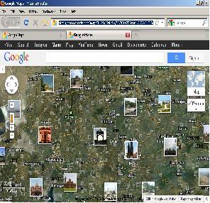 |
See this Google Map with Tourist Sites Photographs |
| Human Development report |
| Did you know!! |
 Contact NCHSE GIS Centre |
| _ | _ |
 >
>