


| Home | GIS for you | Useful GIS | About us | Contact us |
![]()
| MPGIS site & sw | Madhya Pradesh | GIS & Maps |
When you need maps and you do not have knowledge about its source or its availability, let us assist you. ....
Madhya Pradesh Maps on Physiography, Geology, Hydrogeology, Climate, Ground Water, Agro-climate, Minerals, Watershed, Wasteland, Demography, and many more...

| A collection of Maps of entire state with district, block, village boundaries. | Census data on Map: State Map linked to latest Census -2011. | ||
 |
 |
![]()
|
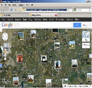
Madhya Pradesh on Active Imagery
Use ARROWS to Pan For wider view goto Google |
Other useful Maps
of MP:

| click on the maps for Zoomed View | |||
 |
Population growth Map: 2001-2011 census. | ||
 |
Urban Population growth: 2001-2011 census | ||
 |
Population density Map: 2011 census | ||
 |
A detailed map of Madhya Pradesh that has the important places, roads, drainage/streams, etc. |
||
 |
Detailed Road map of M.P. | ||
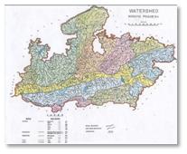 |
Watershed Map of Madhya Pradesh that depicts the Drainages and districts |
||
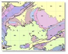 |
Geology map of Madhya Pradesh by GSI in interactive form . |
||
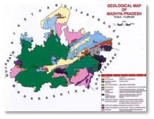 |
Geology map of Madhya Pradesh |
||
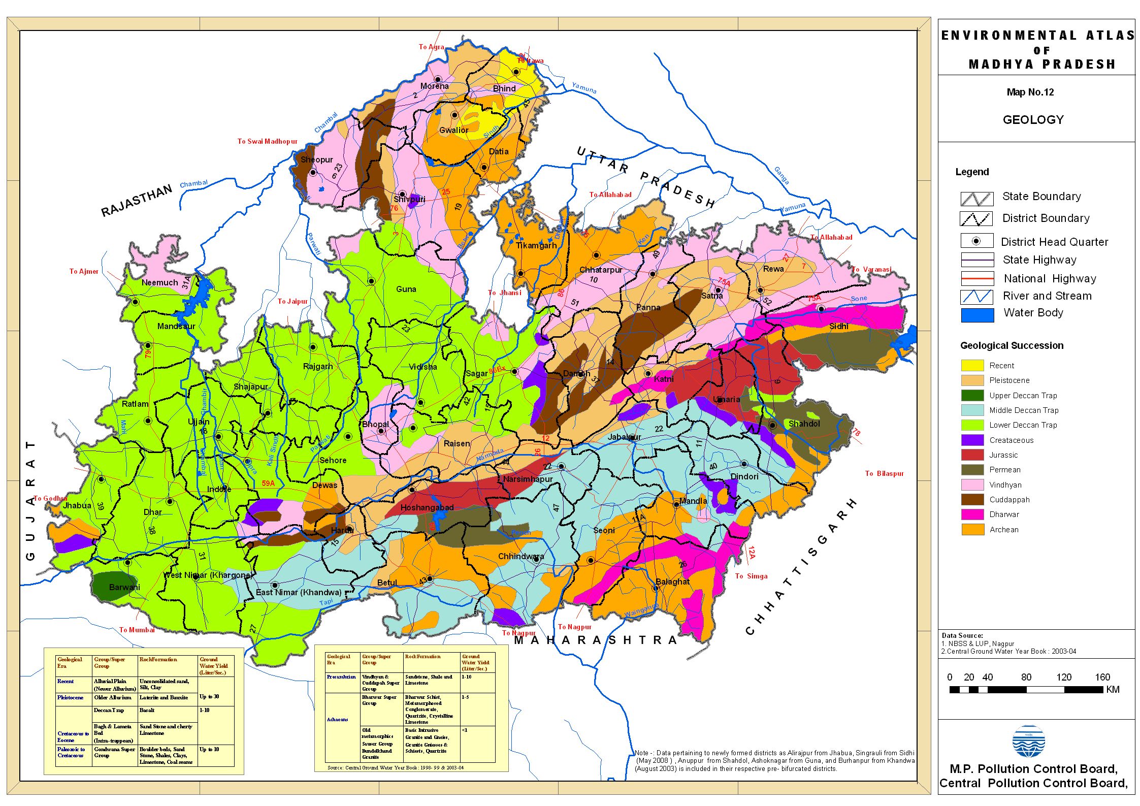 |
Geology map of Madhya Pradesh |
||
 |
The Minerals of Madhya Pradesh | ||
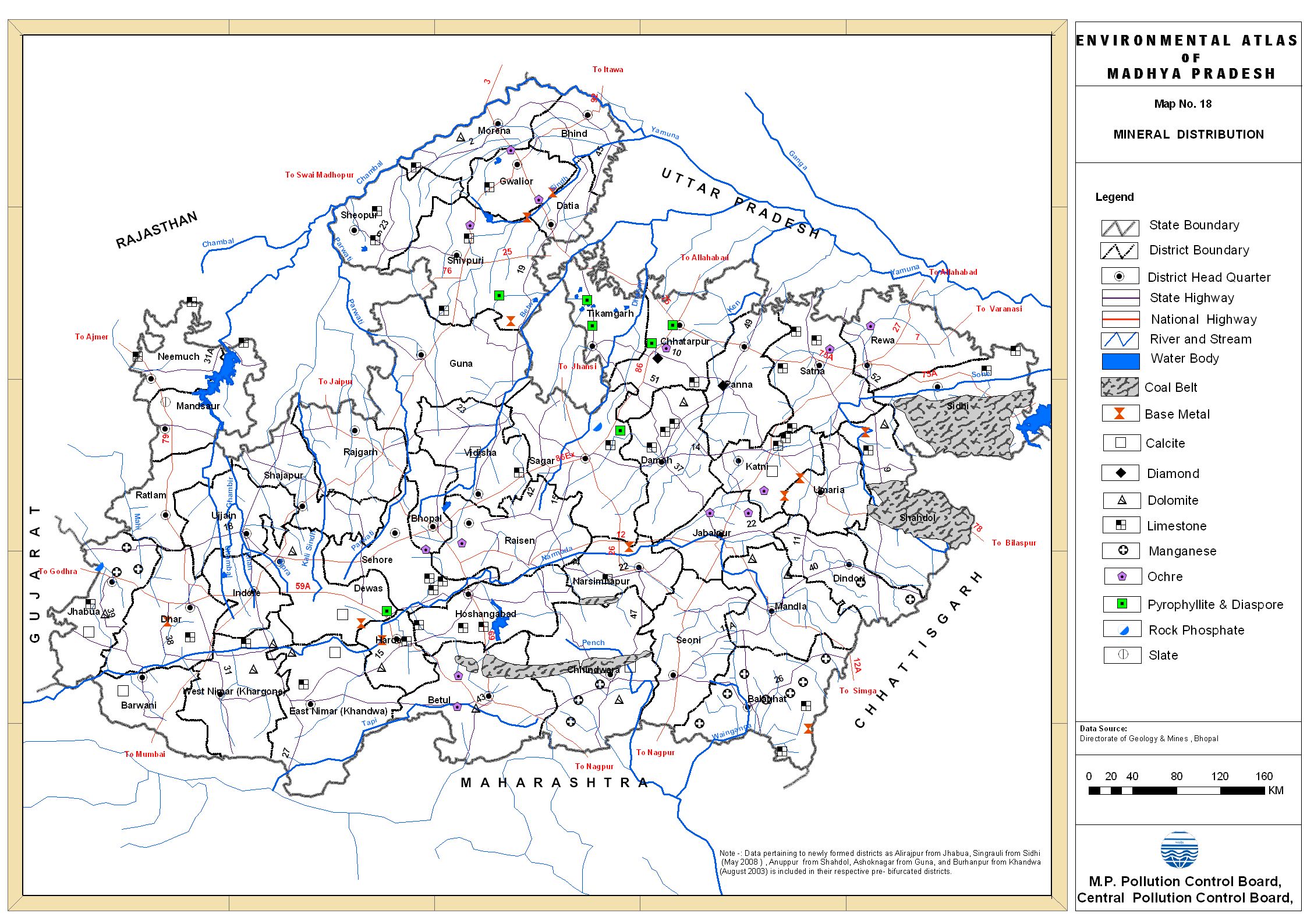 |
The Minerals of Madhya Pradesh | ||
 |
The Minerals of Madhya Pradesh | ||
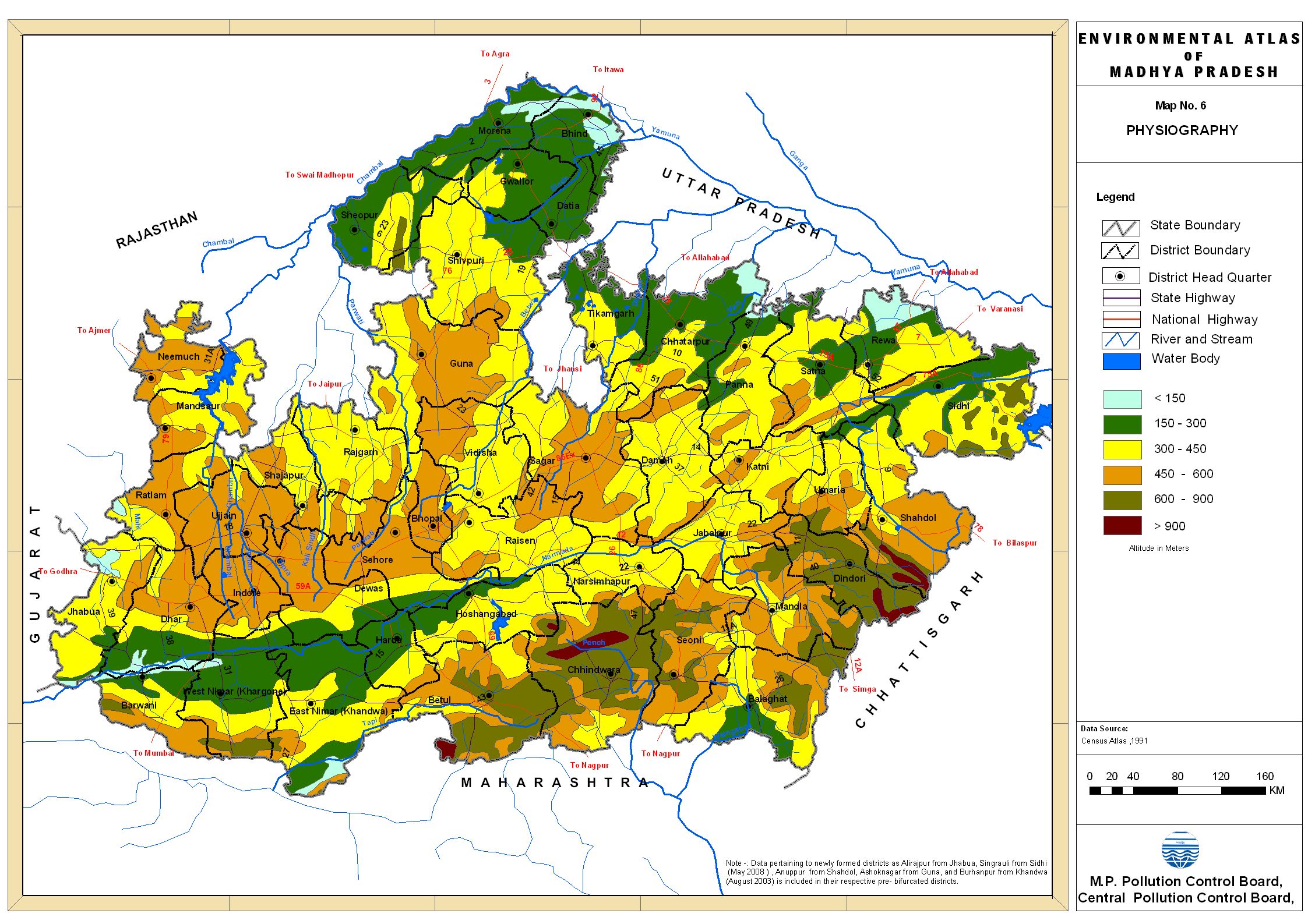 |
Physiography: Pollution Control Board's Atlas |
||
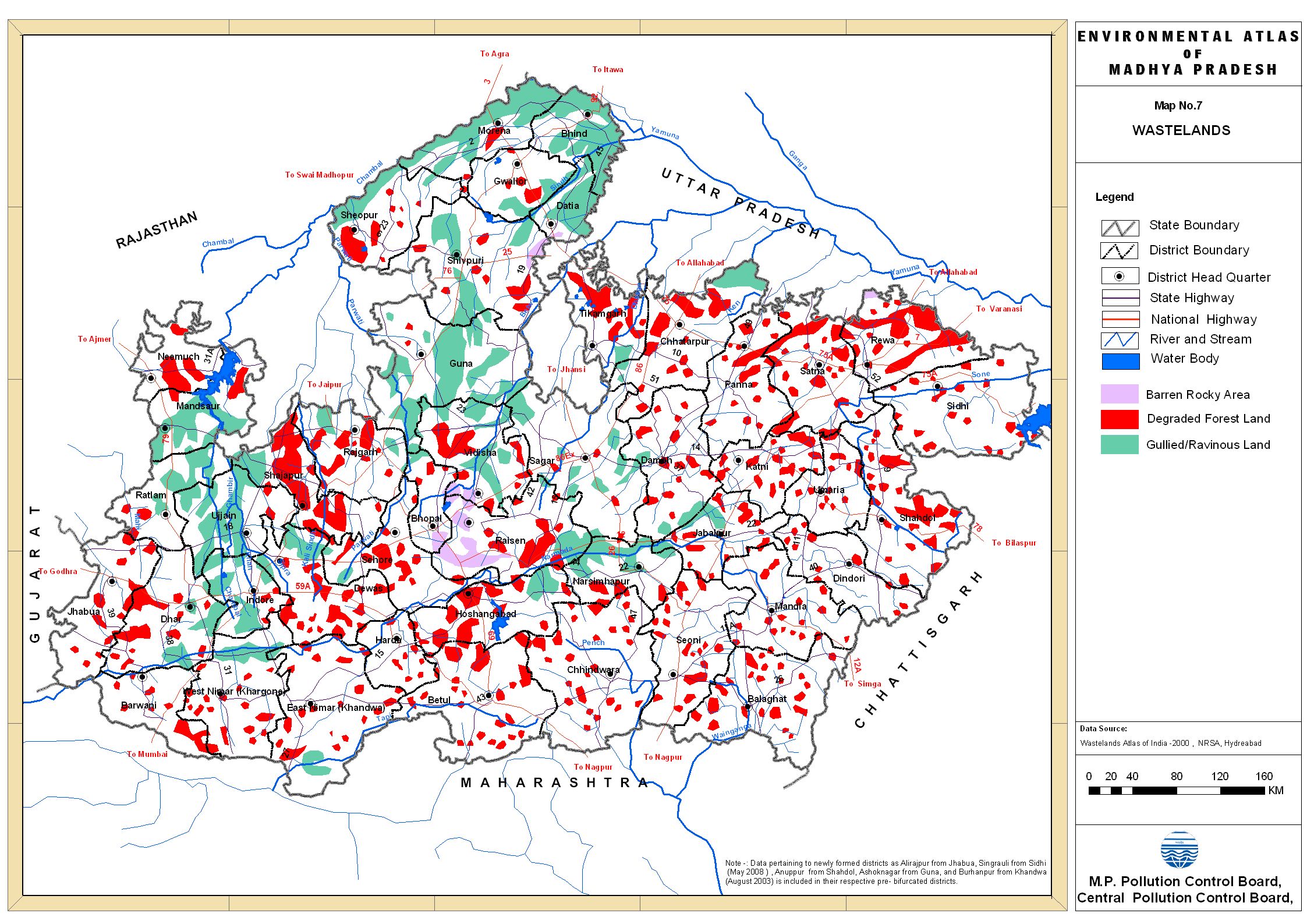 |
Waste Land Map |
||
 |
Forest cover Map of M.P. | ||
 |
AgroclimaticZones of Madhya Pradesh | ||
 |
AgroclimaticZones of Madhya Pradesh | ||
 |
Soil Map of MP | ||
 |
Crop intensity map of Madhya Pradesh | ||
 |
Food Grain map of Madhya Pradesh | ||
 |
This is Madhya Pradesh Tourist sites Map on Google. See photographs on location.. | ||
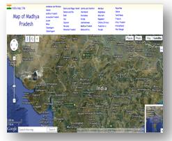 |
MP Map Get here "Interactive Map of madhya Pradesh " with numerous features like photographs of sites, distance calculator, etc. http://indiamapsite.com/madhya_pradesh/ |
||
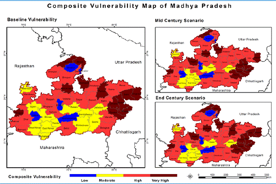 |
The Climate change regarding: Vulnerability map of Madhya Pradesh. Base line, Mid-century scenario and End-century scenario. | ||
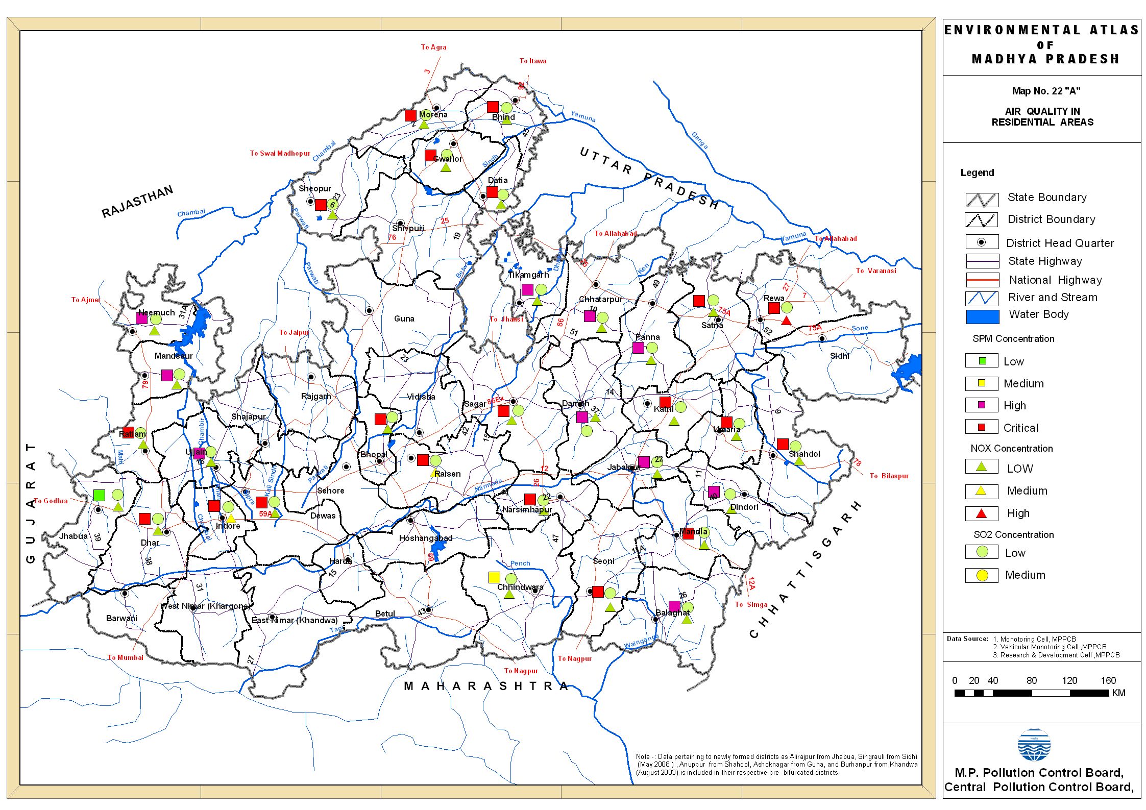 |
Air Quality Residential areas: Pollution Control Board's Atlas |
||
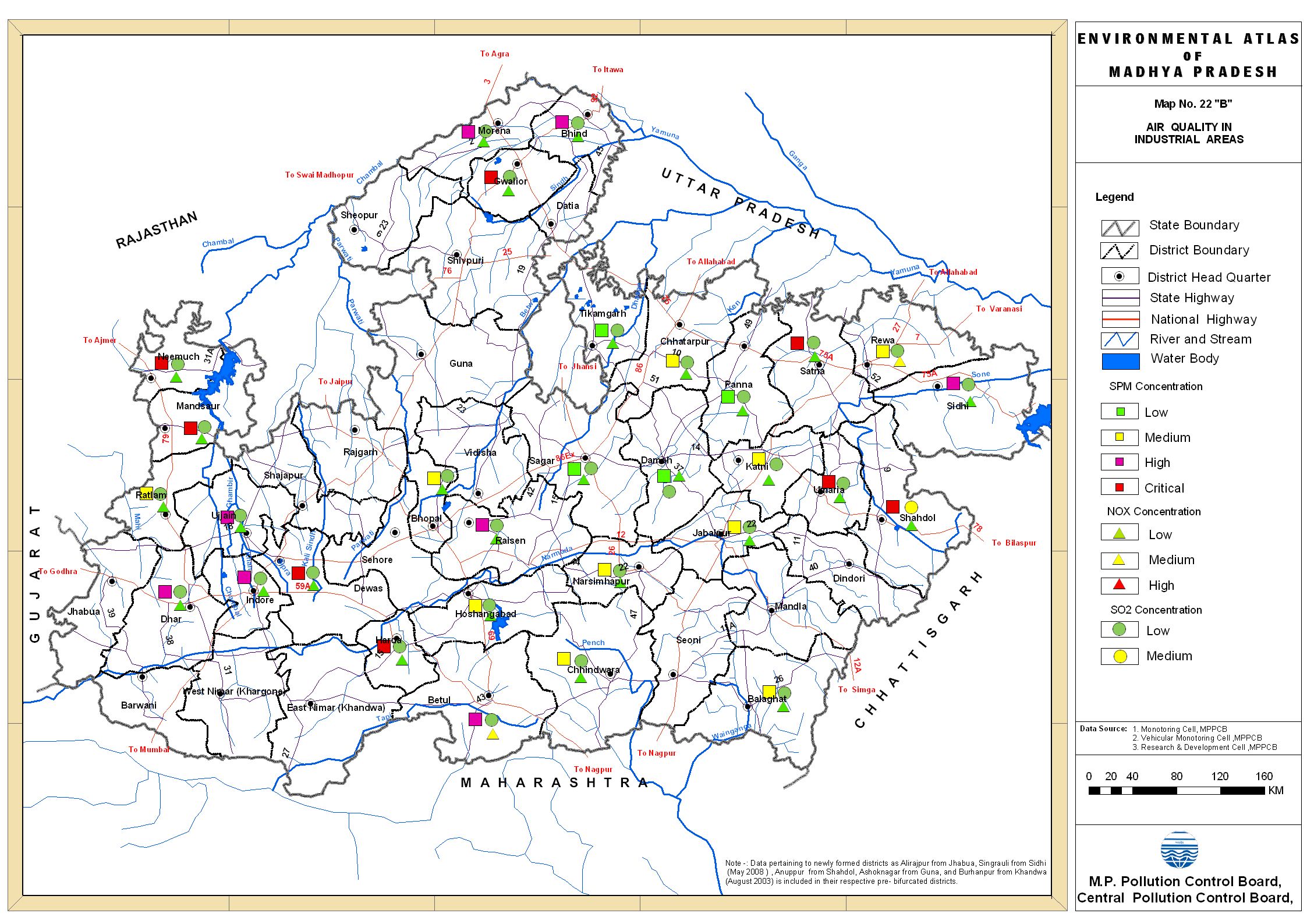 |
Air Quality Industrial areas: Pollution Control Board's Atlas |
||
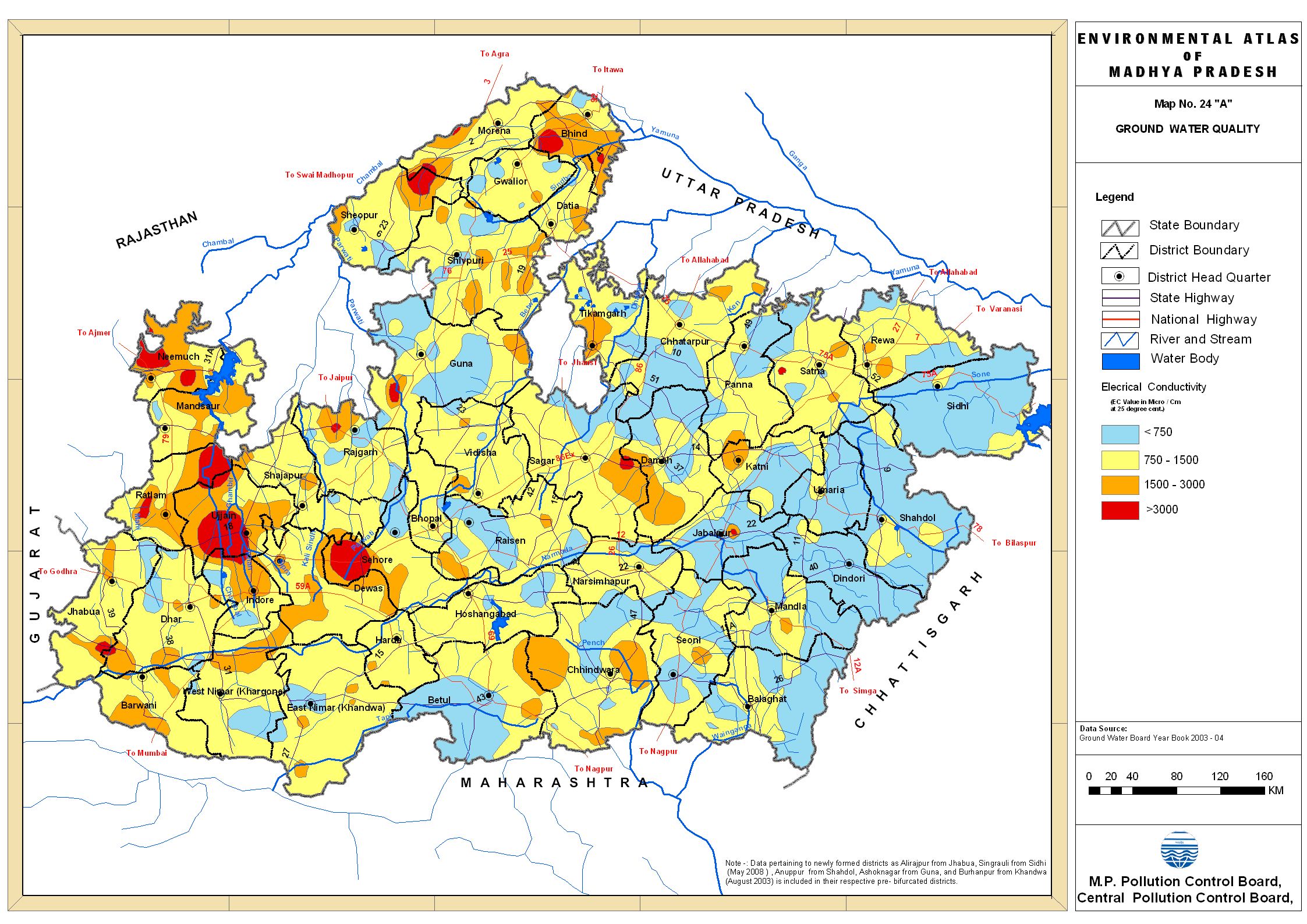 |
Ground Water Quality A: Pollution Control Board's Atlas |
||
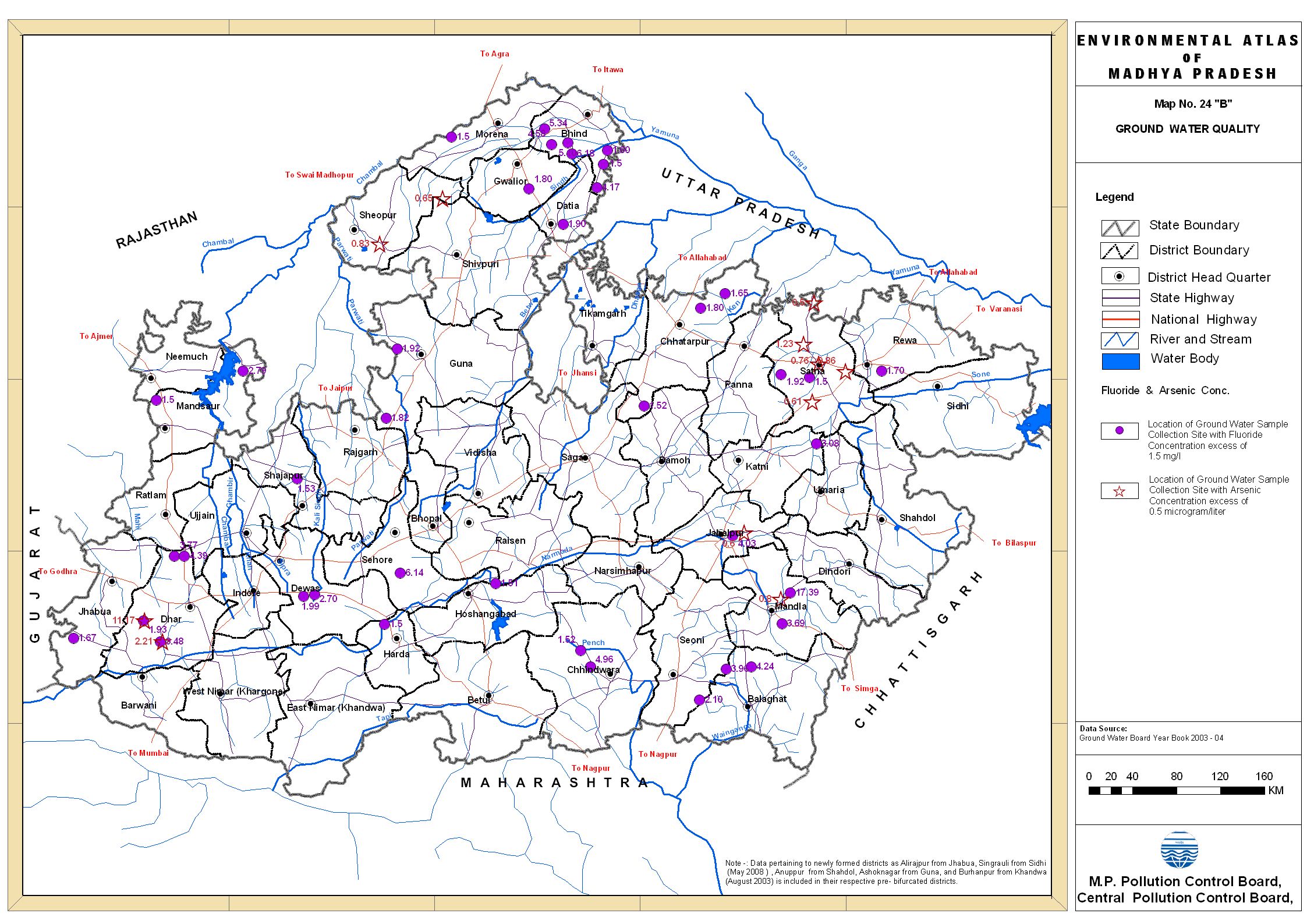 |
Ground Water Quality B: Pollution Control Board's Atlas |
||
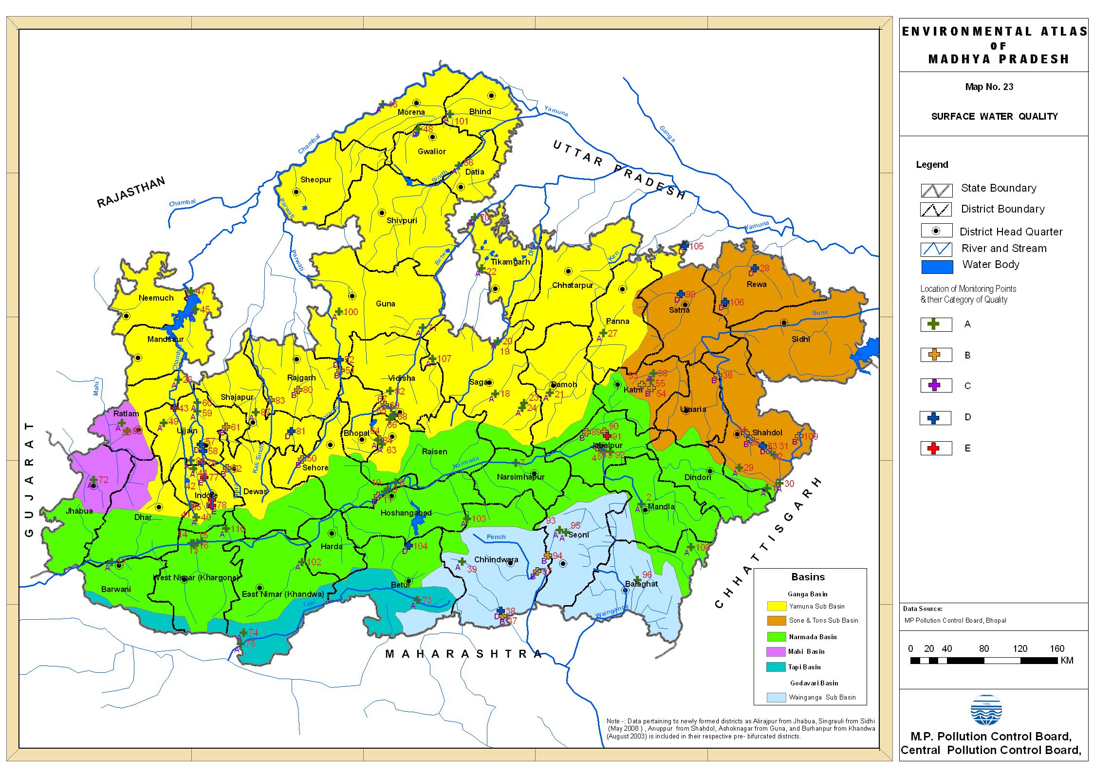 |
Surface Water Quality: Pollution Control Board's Atlas |
||
 |
Hydrogeology map of Madhya Pradesh Ground Water Report of WRD |
||
 |
Climate map of Madhya Pradesh Ground Water Report of WRD |
||
 |
Ground Water Development in MP map Ground Water Report of WRD |
||
 |
Water level map of Madhya Pradesh Ground Water Report of WRD |
||
 |
Ground water status Map | ||
 |
Registered Industries in MP | ||
 |
Minerals based Industries in M.P. | ||
 |
Industries other than those based on Minerals | ||
| Wiki Mapia MADHYA PRADESH |
Wiki Mapia MADHYA PRADESH Get here Satellite Maps of places in Madhya Pradesh http://wikimapia.org/country/India/Madhya_Pradesh/ |
||
The maps given on this site and this page, have been resourced from departments and organisations relating to the subject of respective maps, who have either published these or created them. NCHSE is hosting these maps to make same available to people at large for their help and convenience exactly as these are obtained from the source. NCHSE is not responsible for quality or information given on them and therefore users, in case of doubts, may kindly approach sources of publication or creation for further clarifications, if required. As such most are genuine sources and it is only hoped that this should be collection of best available maps.
| ^Go Top |
 |
Select One |
|||||||
|
||||||||
Did you like this page!!
SHARE with friends and others
|
USEFUL SITES Survey of IndiaNRSA, Hyderabad Census of India NIC GIS MPCOST Forest Survey of India FSI Geological Survey of India |
|
| L E A R N __G I S |
|
WHAT all is on MPGIS: |
| .spatialhydrology.com/freedownload.html |
|
|
|
| ARTICLE on GIS in MP |
Take an online Survey
TECHNOLOGY Vs Participatory Approach
|
Discussing the methodology for Watershed Planning |
There are four phases in which the maps should be developed for any watershed area using the GIS techniques. ______________>>more... _________________________ |
NEED guidance !! |
How to obtain Survey of India toposheets ... How to obtain satellite data from NRSA/ISRO... Read the Map policy of India... ______________ _________________________ |
 |
EXPLORE MORE ON MPGIS |
|
__________________________________________________________________________________________ |