|
|
|
When You Need
District, Block or Village Level
Mapping
A handy, easy to use package.
|
MPGIS
A village level
Mapped database on
Madhya Pradesh
|

| |
 |
Thinking of
Village Identification? Planning activities? Action Plans? or reporting field work progress or doing the impact assessment in a district !!
|
| |
Just Pick the Readymade GIS
'the MPGIS'.
Huge databases do not work. Those are difficult to understand and use. Putting the information on Maps makes jobs easy.
New vision appears with better perception of data. Decision making improves. Here is help to GO IN FOR MAPs !! And to efficiently make use of Mapped information: here is your MPGIS.
MP GIS has the following features: |
|
| |
 |
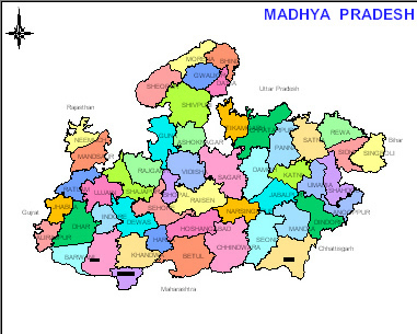
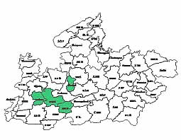
State map with district boundaries, District map with Tehsil boundaries, Tehsil maps with village boundaries |
| |
|
Village level data of census attached to maps |
| |
|
Very user friendly. No need to learn GIS / any other training |
| |
|
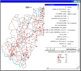
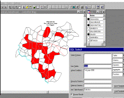
Query features to make selection of villages as per set criteria |
| |
|
Highly useful for state level functionaries, districts authorities, NGOs, reseachers, etc. |
| |
|
Extra support to embed khasra maps and work for micro planning. |
| |
|
|
| |
 | |
 |
| |
_______________________________________________________________________________________________________
|
| |
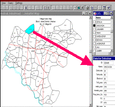
 EASE OF OPERATIONS: EASE OF OPERATIONS:
- The maps are opened simply from selection of the
menu/submenu items.
- Alpha-indexed lists of the blocks and of villages
appear for picking the name if one cannot
recall its location on the
map.
- Short cut menus appear with right click on the map
screen.
|
|
WHERE IT CAN BE USED !!
The
package is most useful for the following:
-
Simply viewing the whole maps with village names
-
General retrieval of information on district, block
and village level
-
Modification of database and adding other information
which makes it possible to orient the package for the needs of any
specific department
-
The database can be used for identification of
villages matching any criteria and thus villages can be selected for
any project/programme quickly and easily |
| |
Planning
for projects/programmes can also be performed using the same
GIS
on
socio-economic and other parameters:
|
| |
The MPGIS also offers another useful feature of adding
multiple layers of information – thus other information can be
mapped (in symbols/lines/text) for making the GIS more meaningful
for the villages.
For example:
-village resources,
-forests,
-agriculture,
-water resources
etc.
related information can be
superimposed.
|
|
| |
____________________________________________________________________________________________________________ |
|