<< Go back

MP GIS

MP GIS
 
Home
GIS for you
Useful GIS
About us
Contact us


Urban Area Mapping


Various kinds of Urban Mapping are performed with emphasis on information at Ward level or if possible household level. The Satellite data is often put to use, as that makes the job easy for data compilation through surveys.


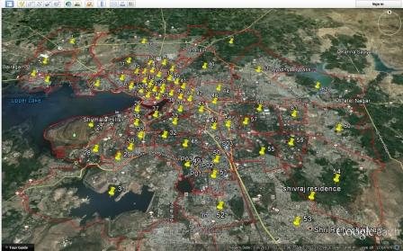
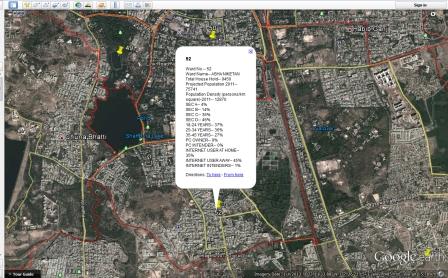
This is the Bhopal city map digitised which consists of various layers such as Ward Boundaries, Roads, Nallah/streams and water bodies, Gardens, Important buildings, Educational Institutions, Banks, Post Offices, etc.

These layers may be mutually superimposed and may help Planning activities effectively.

Multiple other layers may also be added as per requirement.

Such maps may be updated with support of Satellite scenes also.


This is the Google based map, where the Layer of Bhopal wards has been superimposed.

This makes it clear as to which object and place falls within which ward.


Furthermore the Google map was put to use for attaching a survey information that is visible with a click on the Ward boundary.

the adjoining image shows the data.

Lot many useful decsions may be taken based upon exact picture of the area and data attached.