<< Go back

MP GIS

MP GIS
 
Home
GIS for you
Useful GIS
About us
Contact us


Rural Development related GIS Applications:


District, Block, Village Level

Mapping


MPGIS


A village level
Mapped database on
Madhya Pradesh

  The village level information is always desired for any detailed planning, monitoring or reporting. Many databases are available but all are restricted to narrative lists, tables etc. The databases are also not easily perceptible to all – and often become the experts’ property. For commoners, for those needing the information in ready served format so that the same is put to effective use, quickly, the maps are the simplest medium. 

The MP GIS is the VILLAGE DATABASE on MADHYA PRADESH on Maps which comes in handy, easy to use package which is affordable also. MP GIS has the following features:
  Extremely helpful

- in Village Identification
- in Planning activities
- in Action Plans
- in reporting field work progress or
- in doing the impact assessment in a district

 
Why Maps.

Huge databases do not work. Those are difficult to understand and use. Putting the information on Maps makes jobs easy.
New vision appears with better perception of data. Decision making improves.

Here is help to GO IN FOR MAPs !!
And to efficiently make use of Mapped information: here is MPGIS.


The MPGIS has the following features:
  State map with district boundaries, District map with Tehsil boundaries, Tehsil maps with village boundaries
  Village level data of census attached to maps
  Very user friendly. No need to learn GIS / any other training
  Query features to make selection of villages as per set criteria
  Highly useful for state level functionaries, districts authorities, NGOs, reseachers, etc.
  Extra support to embed khasra maps and work for micro planning.


_______________________________________________________________________________________________________


Planning for projects/programmes can also be performed using the same
GIS on socio-economic and other parameters


WHERE TO USE !!
The package is most useful for the following:
- Simply viewing the whole maps with village names

- General retrieval of information on district, block and village level

- Modification of village database and adding other information which makes it possible to orient the package for the needs of any specific department

- The database can be used for identification of villages matching any criteria and thus villages can be selected for any project/programme quickly and easily
 
 
The MPGIS also offers another useful feature of adding multiple layers of information – thus other information can be mapped (in symbols/lines/text) for making the GIS more meaningful for the villages.

For example:
-village resources,
-forests,
-agriculture,
-water resources etc.
related information can be superimposed.

  ____________________________________________________________________________________________________________
 

For further details/procuring the package contact NCHSE .... click here

MPGIS Applications perfomed:
Village identification: MPRLP.
The MPRLP had performed village identification through use of MPGIS village level database.
Several Watershed Planning activities have been performed using Mazmulis of MPGIS
Action Plans are prepared using the Village Database and other micro level data
The other layers superimposed make the MPGIS even more powerful.


MIS for Village Planning

(developed for UNICEF)

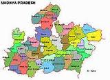
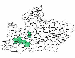
A pcakage for the houshold level information on health and family welfare activities indicators created for two districts of Madhya Pradesh - Guna and Shivpuri which has the general village level statistics.The database is encapsuled in software, which is a user-friendly interactive set of programmes, specially designed for retrieval and use of the information. Broadly, the system offers the following features.

 
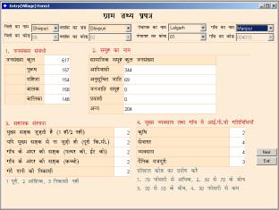
Village level data on General Information, Demographic Profile, Ethnographic details, Support infrastructure, Key Occupation & IGP activities in village, Market/Haat details, Public Offices/ Services in village, Basic Services & Service infrastructure, Available human resource in village is available.
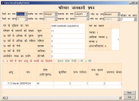
Similarly another set of data Household wise, based on Information/ Data Sheet of family, Details of children below 3 years of age, 3-6 Years, 6-14 years, 14-19 years, Household information Sheet, Family death information is also available.


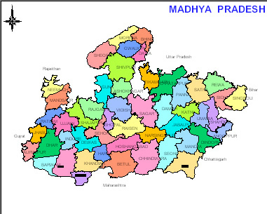
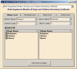
Block level and district level summary may be generated.

The package has simple selection facility to choose village, blocks and district as unit.
 
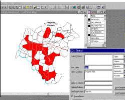
There is also facility to analyse data on different parameters.  There is a set list of queryanalysis items to choose form.  Simple to clubbed queries can be performed.


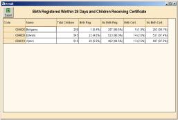
There is also a report format built to view the data.

Together,
here is also a facility available to see the results in form of graphs such as line, bar or pie depending upon best suiting presentation.
 
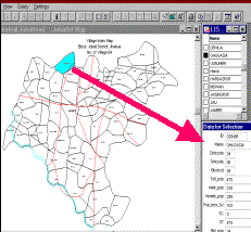
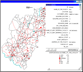
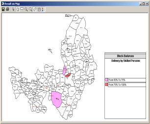
The main feature of the package is to view data on maps at village level. Even the query analysis outputs can be seen on this.
The software may export data to other formats such as excel, Access or other database packages as well as SPSS.  Thus, onward analysis can also be done in other statistical packages.

 
  The package offers another useful feature of updating the data format and  minor other software items from time to time and thus the whole system is quite flexible. This feature can be best utilized to include other sectors’ data in to the package that the some village level data can be expanded for additional fields.