

| Home | GIS for you | Useful GIS | About us | Contact us |
![]()
| Useful GIS | GIS Utilities | Maps & Maps |
|
| click here |
GIS Utilities
![]()
This page is specially designed to offer you a host of GIS Utilities which are of immense utility in GIS and Mapping exercises.
![]()
| A TOOL FOR Lat-Long conversion from Decimal to Degrees/vice versa |
![]()
| Geographic/UTM CoordinateConverter http://home.hiwaay.net/~taylorc/toolbox/geography/geoutm.html You often require to convert the coordinates from Geographic to UTM and also the back from UTM to geographic. The utility is here to do this job with accuracy and with a click._ (...click here)
|

![]()
|
AUTO CONVERSION OF LENGTH and AREA UNIT
This is a magic box. Just fill Anyone Value, anywhere, and then click on Auto-Covert button; this would self calculate other values. When you want to re-do, click on RESET box. |
![]()
Find coordinates of your selected Location OR find a Place on Map
|
|
Present position of
Marker
______________________
____________________ Please Move Pointer or Pan Map for your selection. |
|||||||
![]()
| Error Estimates for WGS-84 and Everest (India-1956) Transformation Mr. B.K. Srivastava, General Manager (Cartography) Mr. K. Ramalingam, Member (Planning), Airports Authority of India. Introduction WGS-84 coordinate System is being adopted universally as the standard form of Geographical Coordinates Representation System. This system has come into existence only towards the end of 20th Century, and prior to that the local coordinate system (Everest or Indian System) had been in use in India for more than 150 years. Thus, most of the maps, records and data are available in the form of Everest system only. Till such time all the records are transformed to WGS-84 and new maps are printed, the local system is also likely to continue along with WGS-84. Thus, a need is felt to assess the extent of error ... >>Read More |
___________________________________________________________________________
|

![]()
The detailed science of Maps:
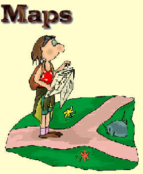 |
Having map in hand is an outcome of very detailed technical process which yields a map that talks geometry of Earth with precision. The maps have scales and they have lot other standards which one must try to understand to understand significance of Mapping. __ [...Read on] _ Important Notes on Maps |
![]()
| Attention Arc Developers: A series of GIS utilities and tools for the Arc and other GIS developers .. right here |
||
 |
![]()
Important: This page presents
picks from the Indian and other websites from the globe. The important utilities with their names and URLs are proposed to be given on this panel of page. These are mainly aimed at helping the GISusers to feel assisted and guided to the proper sites and locations on web. The purpose is solely to provide acedmic support only and in no way there is any attempt to gain commrercially or otherwise from this act.
There is, as such, no special criteria of selection and
providing link here. The editorial team and the supporting technical staff
found these examples worth quoting due to the technical variety and
relevance to beginners or users of GIS.
Any programme or utility being missed out or
not given place here, is absolutely unintentional, and the designers, the
editorial team along with support staff for the website, in no case, must
be held responsible for this. However, we shall welcome addition of
new suitable material if any one refers to us and if you want to do so, please feel free to ask
for it giving the URL.
![]()
DISCLAIMER:
The data and coordinate computations are based on mathematical and geographical functions as per standard formula, methods and other available utilities and tools on Internet. We, NCHSE, MPGIS and designers, in no case, shall be responsible for errors, deviations, etc. of any kind or extent, in the results. However there are rare chances of such mistakes appearing, yet we sincerely advise the users of this website and webpage to cross-check the results at once with the Standard or Known figures.

ADVERTISEMENT OF GIS FIRMS ARE INVITED
Contact us...
![]()
| .spatialhydrology.com/freedownload.html |
|
WHAT all is on MPGIS: |

EXPLORE MORE ON MPGIS |
|
TIRED !!!  ___________________ GAMES TIME: |
|
| Our Website Visitors' Map | |