Introduction
A participatory walk through and Net Planning are the methods adopted to survey and plan area treatments as well as minor drainage line treatments or any kind of interventions to be implemented in each
a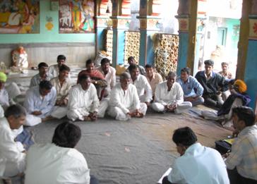 nd every Survey number of the watershed in collaboration with the farmers. nd every Survey number of the watershed in collaboration with the farmers.
The data thus generated is used for collating, organising and analysing data depending upon
needs as well as the kind of information required. It is customized for both the project level
(implementers) as well as the programme level (Managers) for planning, implementing, monitoring and impact assessment purposes.
The software prepares a database of land resources, land ownership by socio-economic classes, soil types, crop varieties, crop pattern, water resources, land use pattern, slope, vegetation etc. And the current status and proposed treatments may also be indicated in this software. It gives micro to macro-level information of the watershed.
This software also helps to prepare demographic details, household category-wise population report, education status, land holding and cropping pattern of the village, livestock details of the village, income and expenditure of families in the village. The information regarding every family in the village can be retrieved in any manner required. Once village information is collected and stored in this software, the software helps to analyse the changes that take place in the
e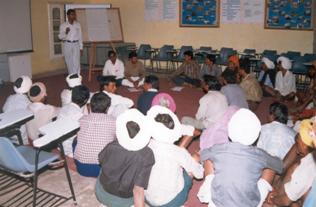 ntire village as well as in each individual family. ntire village as well as in each individual family.
Geographical
layers
Four geographical data layers are provided in this software. These are district boundaries, block boundaries, mazmuli boundaries and village (cadastral) boundaries. From these layers, village (cadastral) boundaries have been created with the help of revenue maps. However, boundaries are indicative instead of exact for the purpose of location and its spread.
Data provided
The district, block and mazmuli boundary layers only have the name of the district, block and mazmuli associated with them. (Other codes should be ignored). The main database is associated with the village (cadastral) layer. In this database, there are some basic data of the village and then the watershed program related data.
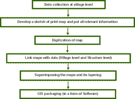
The process of developing this software is as follows:
Usually this software provides information related to baseline data like land ownership, soil types, crop varieties, crop pattern, water resources, land in use, slope, vegetation and flora etc. Proposed activities may also be indicated in this software.
Guidance for Installation of PLANVILLAGE Software (Expecting the system Windows-XP)
1) Install MapInfo Runtime software, if not installed in your system.
Serial No. ruuweu0780004017
2) Now copy <PLANVILLAGE> folder from CD to your system (C:\; or D:\;)[on the root only]
3) Select \PLANVILLAGE\system\PLANVILLAGE.mbx
· Click Right mouse button
· Select Open with option
· Select Choose Program, then choose Browse
· Select c:\Programme files\mapinforuntime \Mapinforuntime.exe
Or
c: \mapinforuntime \Mapinforuntime.exe (This depends on where the MapInfo run-time has been installed)
4) Select the check box “Always use this programme to open”.
5) Create Shortcut Key on Desktop
· In Explorer, Select \PLANVILLAGE\system\PLANVILLAGE.mbx
· Click on Right mouse button
· Select send to à Desktop (create shortcut) button
6) To create Icon in Programme menu:
· In Startup Bar
· Select Control Panel, Choose Taskbar & Start Menu
· Select Classic Start Menu
· Click on Customize option
· Click ADD Button
· In command line Select the file by browse button
\PLANVILLAGE\system\PLANVILLAGE.mbx
· Click on NEXT – NEXT button · Click on finish button
· Click on OK button.
|