Introduction
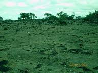
It was so difficult for the people of this village before the decade that they had nothing but miles to walk to get water. It is never seen anywhere that an area could have had such extreme poor water table, poor soil quality and worse vegetation cover.:
Then came the initiative from the Sahoyog Mitras, who went to the field and talked to the poeple. Asked them what is the reason that they have to come to this situation. The answer was - blank. The leader of our group Proma Pandey could in an instant realise that the question qould never get answered. Had we left it at that stage, they would have been the same state ever and ever. But thank God and thank our team, who edicatedly worked to get changes in the area with people, hand in hand, and today it is complete heaven for them.
| |
OUR STEPS:
Since the 1978, it was learnt, the excess use of fertilisers in the area, constant soil erosion and poor recharge has created all damage. Surprisingly people knew the fate, but had no idea to employ for alternatives. As on 2007, the situation went beyond control when farming became impossible, and the people had no choice but to migrate.
|
|
| |
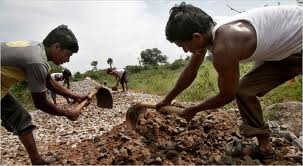
We had to take a trial by offering them external support for which we linked some of the ongoing projects in the area. These were mainly for water conservation, soil conservation, etc.such as watershed. |
|
Education was the first thing we had to take, followed by demonstration. The efforts were not easy since the villagers had very little faith in change.
|
| |
|
| |
 |
We also studied the area, scientifically and explained the situation to people - also told them that solutions were possible. |
| |
|
|
| |
Rest all was the magic of two things:
1. efforts of our field team to work with people
2. GIS based thematic mapping to find solutions |
|
| |
|
|
| |
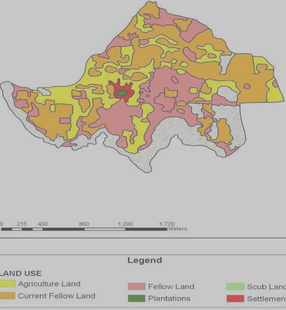
As regards the GIS assistance, there were maps. The area's general resource map, landuse, land ownership, drainage, soil, slope, and so on. These maps were used for the purposes:
1. to identify the potential of the area
2. to map the problems/requirement of the area
and
3. finally, recommend the solution activities |
 |
| |
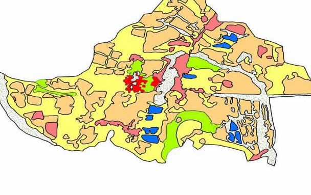
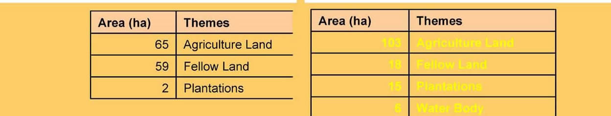
RESULTS Pre- and Post compared
 |
In fact the secret of the whole programme was the use of GIS based techniques for Action Plan preparation. This lead to productive implementation of the programme.
Team members: Ram Narayan Poddar, Girish Naik, Kuldeep Saxena and Smita Chouhan.

|